A Rumor of Spring
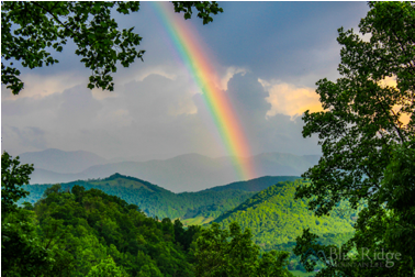
There is a persistent rumor that Spring 2021 is coming to our Blue Ridge Mountains and it is bringing with it daffodils, mountain laurel, flowering dogwood, bluets, crocus and a broad pallet of colors and aromas.
As always with the rumor of Spring, many of our readers are thinking about getting outside, walking in the woods, planting gardens, and renewing their spirts. In the Spring 2021, the urge for all of us to renew our spirts seems particularly strong.
With that in mind, Friends of the Blue Ridge Mountains (FBRM) has a few suggested trails and walks you may want to consider adding to your to-do list this Spring. Of course, in this area we are all blessed with an abundance of interesting, safe, and beautiful trails and walks to choose from regardless of whether we are looking for a peaceful hour or two stroll or a multiday challenging adventure. We have national parks, state parks, county parks and many local jurisdictions have their own parks. We can choose from historically significant venues to awesome views.
A few of our favorite and interesting trails include:
Cool Springs Battlefield – This is a 2.7-mile paved asphalt loop trail located at Shenandoah University River Campus adjacent to the Shenandoah River in Clarke County. The trail features a waterfall and a wooden bridge. Despite being paved, only the southern loop is wheelchair accessible and even there, roots may present difficulties. The northern loop is steeper and not wheelchair friendly. The site is a former golf club that is being returned to its natural state by Shenandoah University.
In 2012 Shenandoah University reached an agreement with the Civil War Trust to preserve 195 acres along the Shenandoah River at the site of an 1864 battle between Union and Confederate forces.
Today, the ground the Confederate soldiers defended is owned by a Trappist Monastery while the ground from which the Union forces began their charge is now in the care of the University. The University will use this land for environmental, historical (including native American) studies and community passive recreation where the public is invited to walk the trails along this scenic river while learning the land’s varied and fascinating history.
It is a great trail for bird enthusiasts. There is a great Blue Heron Rookery easily visible across the river.
The northern loop of the trail also connects directly to the Ridge-to-River Trail which connects to the Appalachian Trail and onto Ravens Rock.
From Leesburg take Route 7 west. About ½ mile east of crossing the Shenandoah River turn north (right) onto Parker Lane (F709) drive about 1.5 miles to a parking lot. Generally, there are plenty of empty spaces. There you will find a board explaining the trail and paper guides highlighting aspects of the trail and information about the Civil War Battle of Cool Springs.
Dogs on a leash are welcome.
For other trails in Clarke County, the Clarke County Conservation Easement Authority has prepared a very nice two-page brochure with a map and information about 13 different parks and hikes in the county. The brochure can be accessed at www.clarkelandconservation.
Manassas Battlefield Trails – The Manassas National Battlefield Park covers more than 5,000 acres with more than 40 miles of looped trails crossing key areas of both the First and Second Manassas Battlefields. Many of the trails feature trailside interpretive markers describing the action and highlighting the experiences of soldiers and civilians alike.
Many of the trails are heavily used during summer weekends. However, I have been on the trails on a summer weekday morning and seen no one on a 5- or 6-mile walk, particularly if you start early – 8:00 AM.
The First Battle of Manassas Trail Loop is 5.2 miles with about ½ mile of it along Bull Run. If you start at the Henry Hill Visitor Center – park there space permitting – and hike in a counterclockwise direction you will pass the sites where events took place in chronological order.
The Second Battle of Manassas Trail is also a loop trail and is about 6.2 miles long. This trail crosses busy Lee highway (Route 29) in two places and is quite close to Sudley Road in several stretches. Much of this trail is in the open so bring a hat and sunscreen.
One of the nicest aspects of the Manassas Battlefield trails is that most are interconnected and you can easily string together a walk as long or short as fits your schedule and stamina. Your leased dog is welcome.
Before setting out on your hike, stop by the Park Visitor Center to obtain a trail map. The park is open daily from sunrise to sunset except for national holidays. Currently there is no fee.
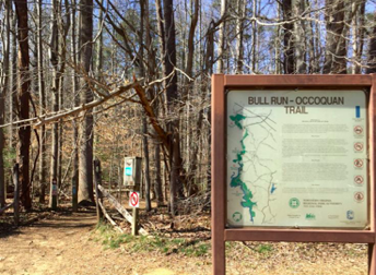
Bull Run – Occoquan Trail – This is a 17.9-mile trail one way. It is not a loop. The trail is the longest natural surface trail in the NOVA Park system. It is not designed for overnight camping along the trail.
Considering the proximity to Washington DC, the Bull Run – Occoquan trail is surprisingly remote with limited access points. In 2006 it was designated a “national recreational trail”. The National Recreation Trail Program is co-sponsored by the National Park Service, U.S. Forest Service, and American Trails, the program’s lead non-profit partner. National Recreation Trails are designated as such by the Secretary of Interior or the Secretary of Agriculture to recognize exemplary trails of local and regional significance.
The northern terminus is at Bull Run Regional Park and the southern terminus is at Fountainhead Regional Park. Most of the trail follows the Bull Run but where the bank or feeder streams are impassable, the trail ascends into the hills. The trail can be seasonally muddy and there can be challenging stream crossings. The trail is also open to equestrians. There are side branches for horses in places where the trail is too rocky or steep for horses. 
Oatlands Plantation Trail Network — Oatlands is operated by the National Trust for Historic Preservation and is listed on the National Register of Historic Places as a National Historic Landmark. The Oatlands property is composed of the main mansion and 415 acres of farmland, gardens, and outbuildings. Many experts consider the house to be one of the finest examples of a Federal period country estate in the nation.
 Oatlands historic house and gardens has 8.5 miles of trails which can be used with the purchase of the $10 day pass or on a yearly basis with any level of Oatlands’ Membership. The pass also allows you to walk through the Oatlands Inner Core Grounds, English Gardens and to view the many historic structures.
The Oatlands trail network is new, having its grand opening celebration on April 4, 2020. It has been constructed by volunteers from the Sierra Club, Potomac Region Outings, and the Potomac Heritage Trail Association. The intention of the National Historic Trust is that the new trail system will soon become a major destination for hikers, horseback riders, and mountain bikers throughout the Washington Metropolitan Area. Plans also call for Oatlands to be the start of a future long distance Goose Creek Stream Valley Trail stretching from Oatlands to the Potomac Heritage National Scenic Trail on the Potomac River.
On the trails you can wander through towering hardwood forests, stream valleys, and open meadows all with excellent views of Bull Run Mountain and one of the most historic early American homes in Virginia.
Various trails are designated for hikers, cyclists, and equestrians. Dogs and other pets, with the exception of service dogs, are prohibited on the property.
Instead of a $10 day pass, annual memberships are available and range from $50/year for one adult up to $5,000/year for 2 adults and children. Each level of membership includes a variety of different discounts, perks, and access to events. All annual memberships include year-round access to all trails.
Balls Bluff Park — Ball’s Bluff Battlefield Regional Park preserves the site of one of the largest Civil War engagements in Loudoun County. The battle was fought on October 21, 1861 as part of Union Maj. Gen. George B. McClellan’s operations in Northern Virginia. While a minor engagement in comparison with the battles that would take place in years to follow, the Battle of Balls Bluff had repercussions in the Union Army’s chain of command structure and raised separation of powers issues under the United States Constitution during the war.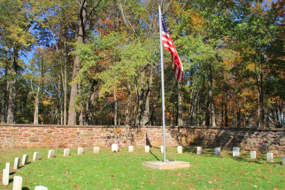
Balls Bluff Regional Park is part of the NOVA Park system. The park is open for hiking/self-guided tours from dawn to dusk seven days a week. Guided tours are generally available on weekends April through November.
Ball’s Bluff Regional Park Loop is a 2.3 mile heavily trafficked loop trail, much of it through woods. A portion of the trail is along the Potomac Heritage Trail and has nice views of the Potomac River. There are several creek crossings and trail conditions can be muddy/slippery after rains or snow.
There are many interconnected trails in Balls Bluff Park and it is possible to arrange a walk of almost any length. However, some people have complained online that the trails are not well marked.
Leashed dogs are welcome and, as the park is quite near residential areas, it is popular with dog owners. Not everyone is conscientious about picking up after their pets.
 Blue Ridge Center for Environmental Stewardship — In 1999 the Robert and Dee Leggett Foundation purchased Mountain View Farm in the Northwestern corner of Loudoun County about halfway between Neersville and Loudoun Heights. There is still a working farm on the site with a Community Supported Agriculture (CSA) program. In addition to the farm, the site includes the Blue Ridge Center for Environmental Stewardship (BRCES). BRCES is a nonprofit organization that manages nearly 900 acres. Besides the farm, the property features a 10-mile network of hiking trails through deep woods, streams, wildflower meadows, and historic farmsteads.
The trails are free to the public and open from dawn until dusk every day of the year. According to BRCES’ website there are four specific trails:
- Farmstead Loop: The Blue Ridge Center’s signature hiking trail. Just over a mile long and with minimal elevation change, the trail is perfect for all ages and fitness levels. This scenic trail, once a road through a 19th century farming community, passes by multiple historic structures, Wortman Pond, and Piney Run.
- Legacy Loop: Crossing Piney Run from the Farmstead Loop, wind your way toward Gordon Pond. Relax and take in one of the most scenic areas of the Blue Ridge Center, with the foliage of the ridge reflecting in the wa
 ter.
ter. - Butterfly Ally: This more challenging trail is situated in the Blue Ridge Center’s backcountry. Hike uphill to connect with the Wood Thrush Trail or keep climbing the mountainside and meet up with the Appalachian Trail.
- Birds of the Ridge: See why BRCES is a stop along the Virginia Bird & Wildlife Trail.
All the trails are accessed from the main trailhead, 100 yards from the parking area where the gravel road splits to the right.
Piney Run passes through the middle of the property on its way to the Potomac River. The run has a beautiful lunch spot on a small island where the Old Bridge Trail crosses it, as well as a large wetlands area that is visible from both the Piney Spur Trail, and Legacy Loop.
The entrance to the BRCES is approximately 2.25 miles north of Neersville on Harpers Ferry Road (Route 671). The entrance is easy to miss. Look for a small sign on the west side (right as you are going north).
 Discussions and negotiations have been underway since at least 2014 to convert the BRCES site to a state park. Gov. Bob McDonnell announced plans for the park just before leaving office in 2014. Since then, efforts have focused on transferring the assemblage of land to the state government. In October 2018, The Loudoun County Board of Supervisors reached an agreement with the Robert and Dee Leggett Foundation to purchase 281 acres of the site for $2.9 million. The property was appraised at $3.5 million in 2016. The county’s acreage, in combination with the 604 acres that the Foundation had already donated to the Commonwealth, will create a state park of almost 900 acres.
Loudoun County Parks and Trails System Study – In July 2020 FBRM distributed a Happenings about Loudoun County’s first steps to create a Countywide network of multiuse trails. The County’s program builds upon the Emerald Ribbon concept that local conservation groups such as The Loudoun County Preservation and Conservation Coalition (LCPCC) and the Piedmont Environmental Council (PEC) have been advocating for years. The county has hired a consultant — Design Workshop– to develop initial plans for a countywide system of trails, do a needs assessment, conduct public outreach, and develop detailed plans for an initial “signature” project. The “signature” project will connect the Washington & Old Dominion (W&OD) Trail with the Potomac Heritage National Scenic Trail to create a single 17.5-mile loop trail.
The consultant delivered a report to the Transportation and Land Use Committee (TULC) of the Board of Supervisors on February 17, 2021 with a follow up report dealing with equity issue on March 17, 2021. The final report is due April 15th, 2021.
Cautions – As any responsible publication must, we mention a few cautions about enjoying trails and hikes. In September 2020 FBRM published a whole Happenings about how to stay safe in the woods and on the trails. A few of the points include:
- When hiking respect all of the rules and regulations of the park.
- Respect all COVID restrictions.
- Stay on the designated trails.
- If you feel you are lost or feel unsafe for any reason, call 911 immediately – do not wait. All of the police, fire and rescue units in the area would much rather deal with a minor incident than a full-blown emergency. Even if you think you are out of cell phone range, 911 calls will often go through.
- Teach you kids to stop and wait for someone to find them if they think they are lost. Tell them not to wander looking for help.
- Wild animals, even if cute little babies or if injured, are dangerous.
- Make sure someone knows where you are going and when you expect to be back.
Conclusion
Now is a great time to begin to get back out onto the many miles of trails in our area. We are blessed in this area with trails and walks for any skill or experience level. With a basic degree of caution and foresight, walking any of our trails is safe, invigorating and soul restoring. Please take advantage of that which is so close to us.



Leave a Reply
Your email is safe with us.